Pointe Percée (2752m)

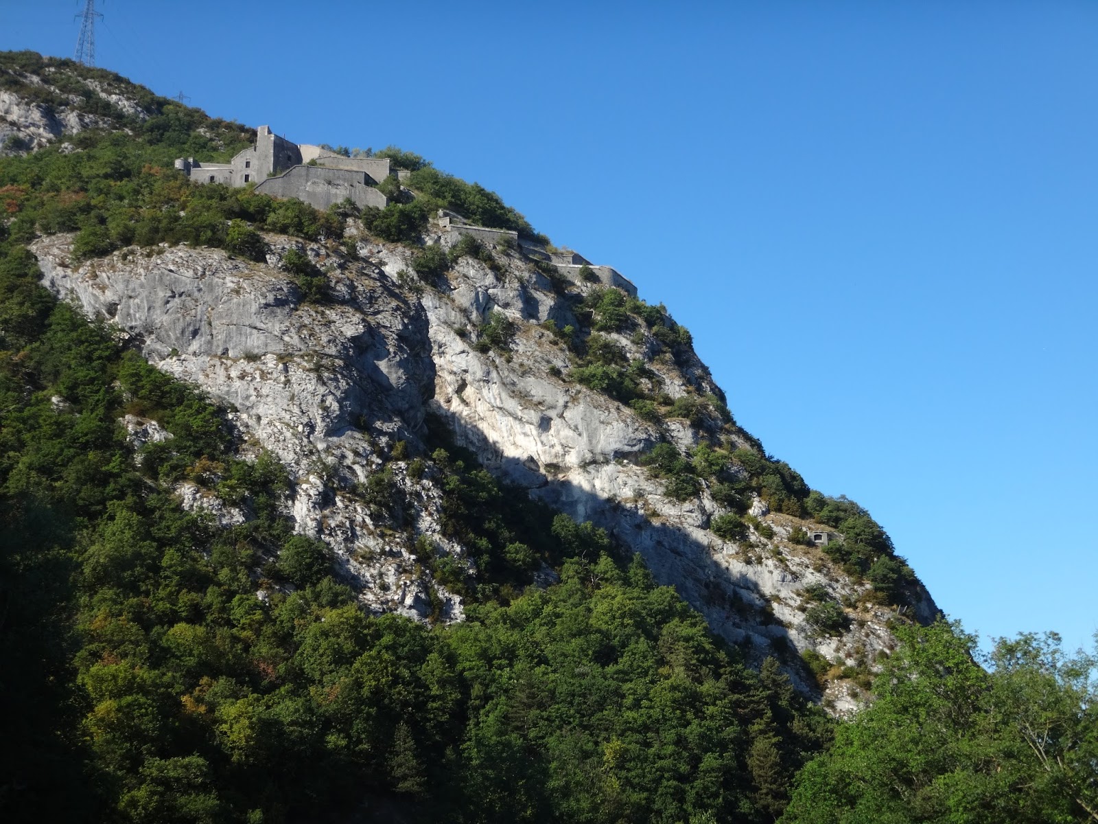
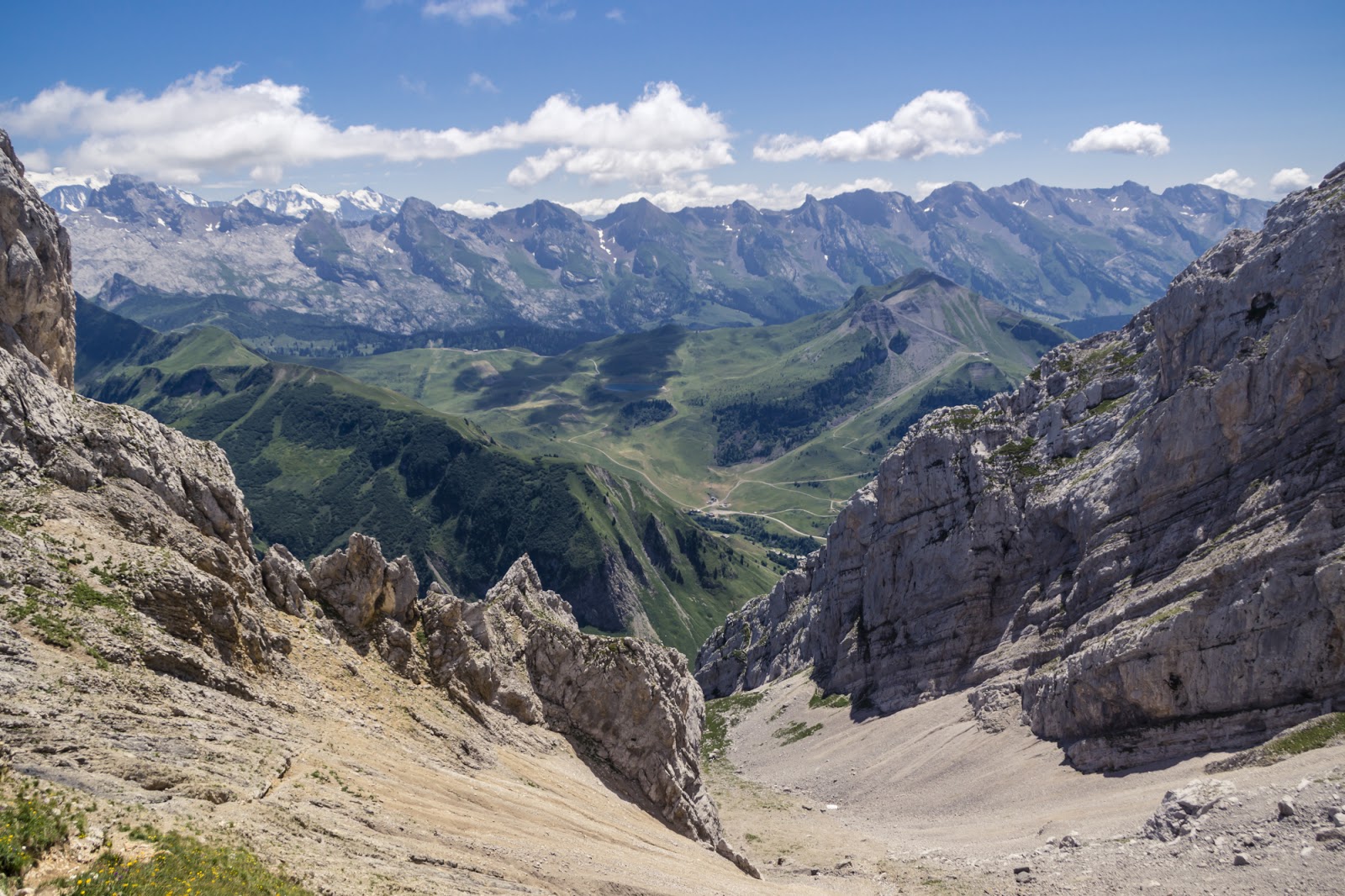
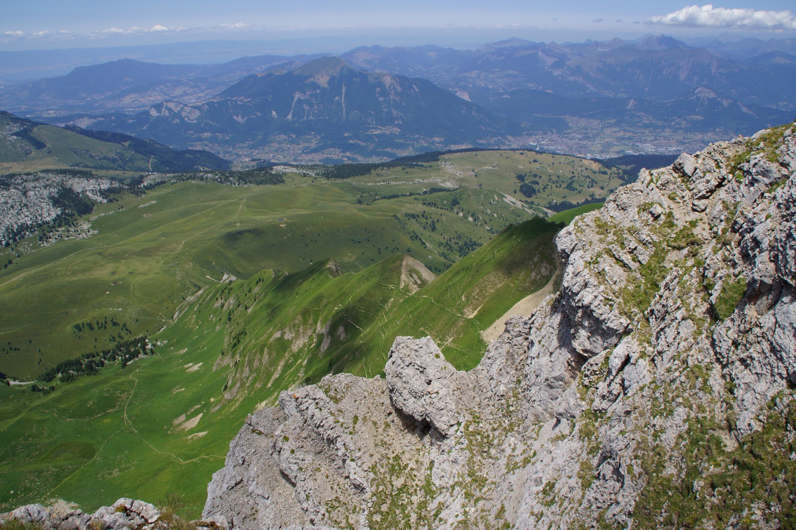
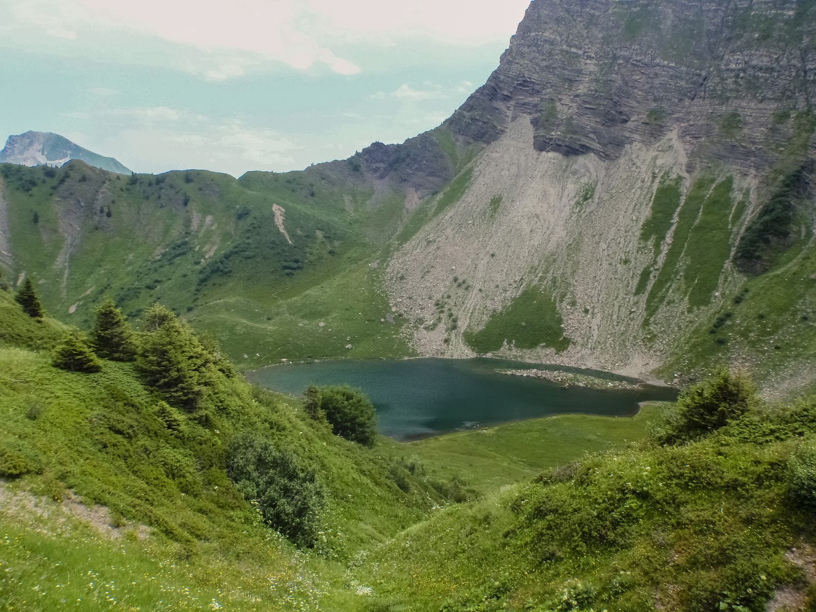
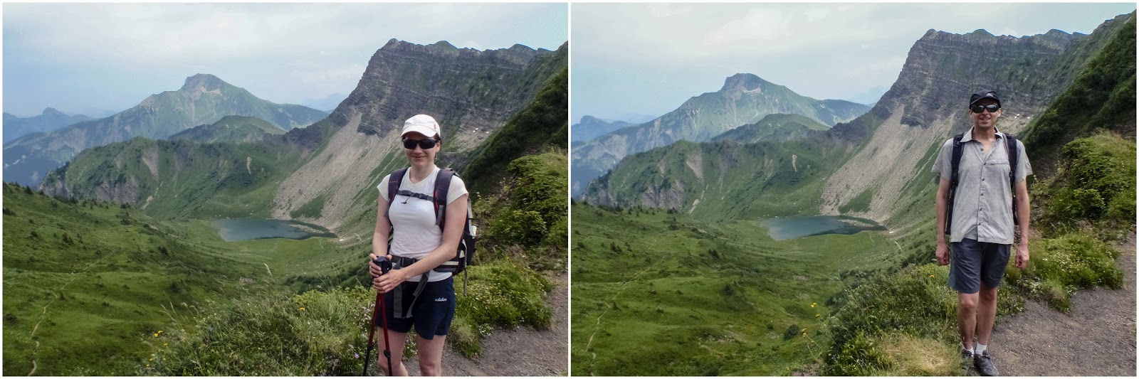
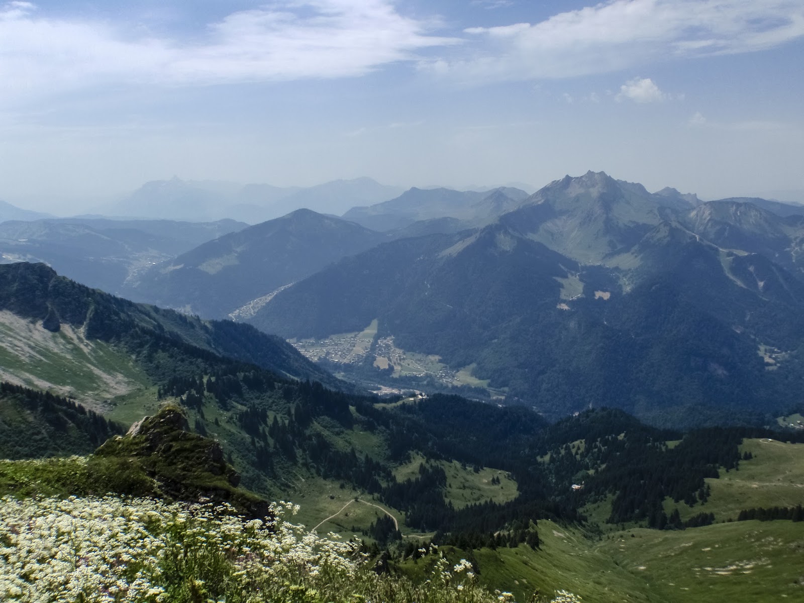
Holy Graal of Aravis – Pointe Percée. The first time I heard about this mountain was 2 years ago in winter when one of my colleagues proposed to hike it in ice and snow. I was wise enough to turn down this offer but put my focus on this mountain and started sniffing around the route. In the end, it’s not that often to see a T5 hiking grade. In the next two years I heard a lot about it. That one should not underestimate it, that it is extremely difficult etc. The legend of the mountain grew strong and fearsome. At some point I even decided to check it myself from a close up and I went up Col des Verts to have a look. This is when I took the most beautiful picture from all of photos I did in mountains. But we chickened out that day and didn’t hike up to Pointe Percee. But this summer is different.

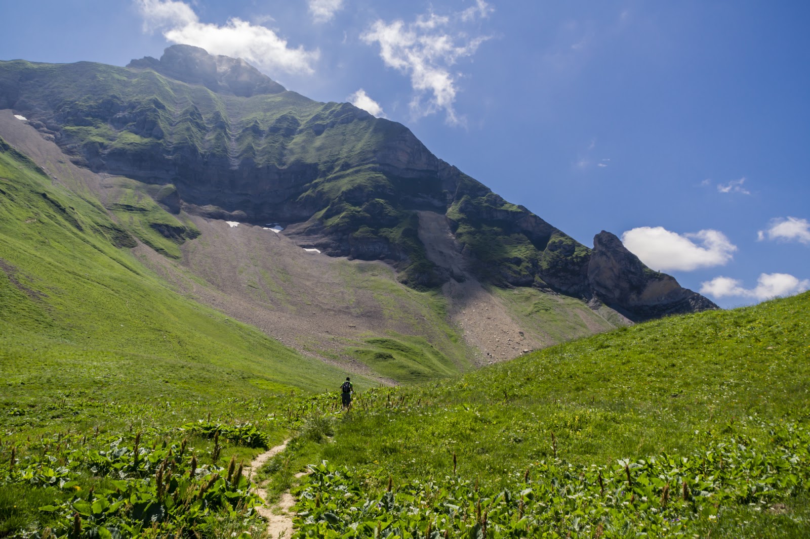
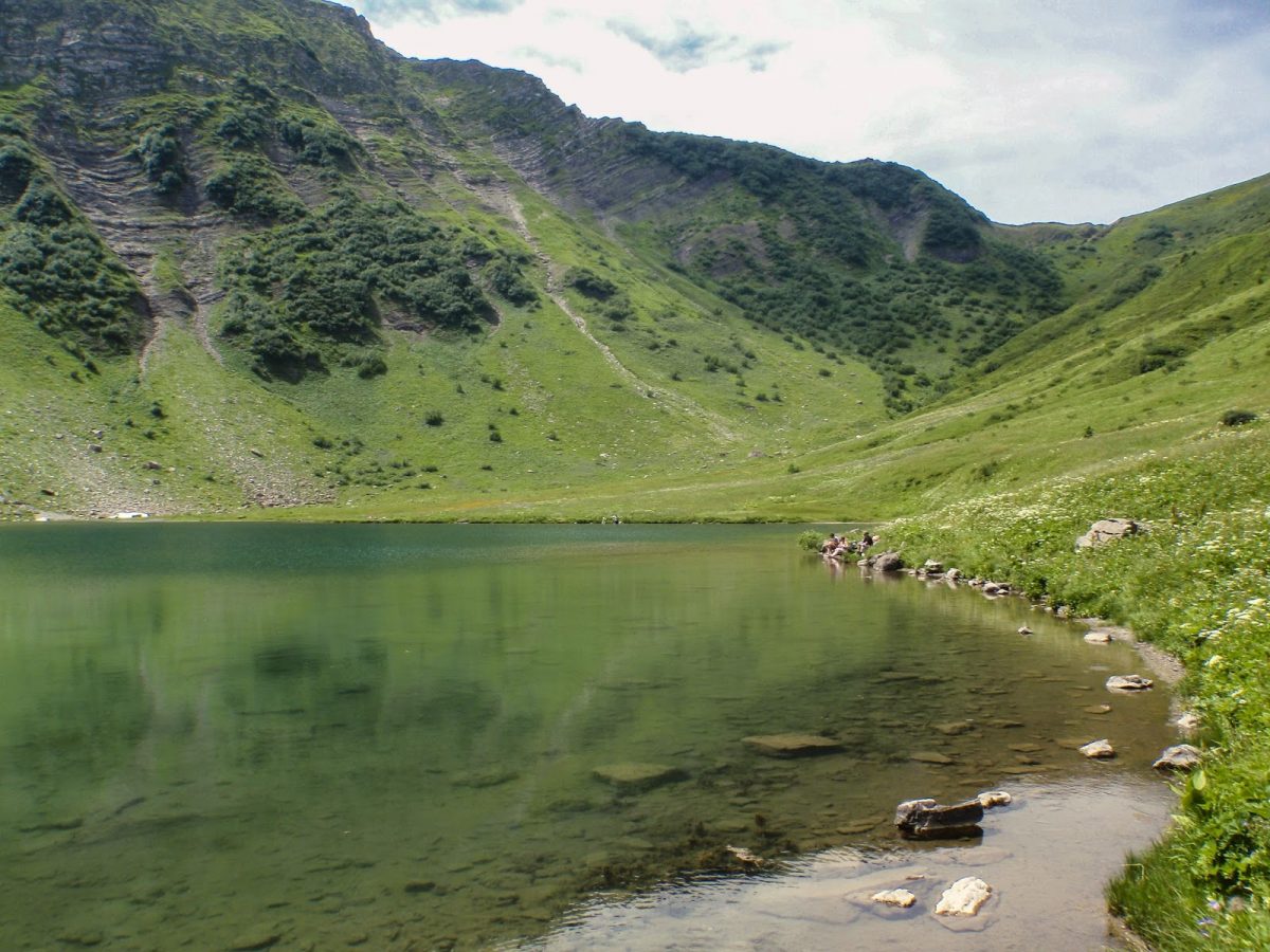
There are two possible routes to Pointe Percee – a T4 one that goes up and down by the same steps; and a T5 one that goes in a loop through Col des Verts. We tried the latter. We already knew the path to the col so it went easy and smooth to reach it. A short break on the ridge and the true fun began.

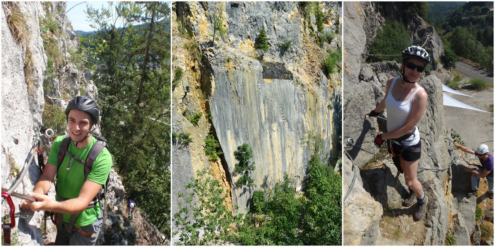
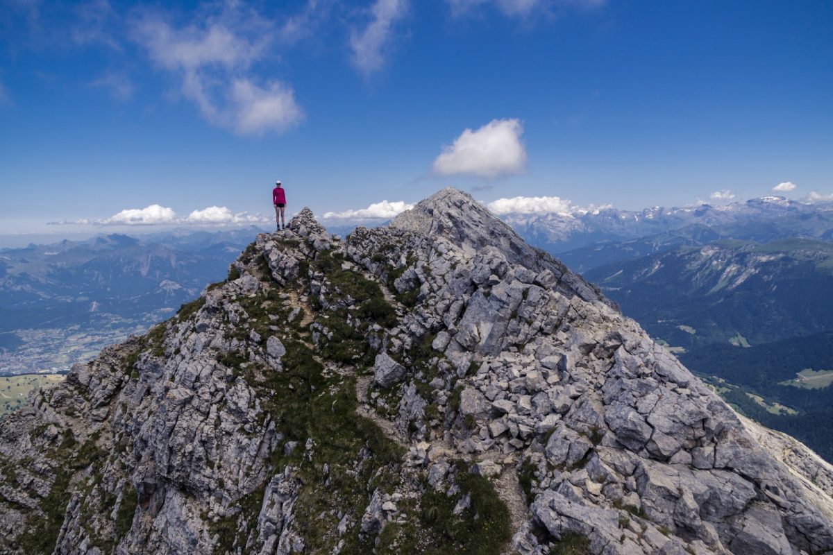
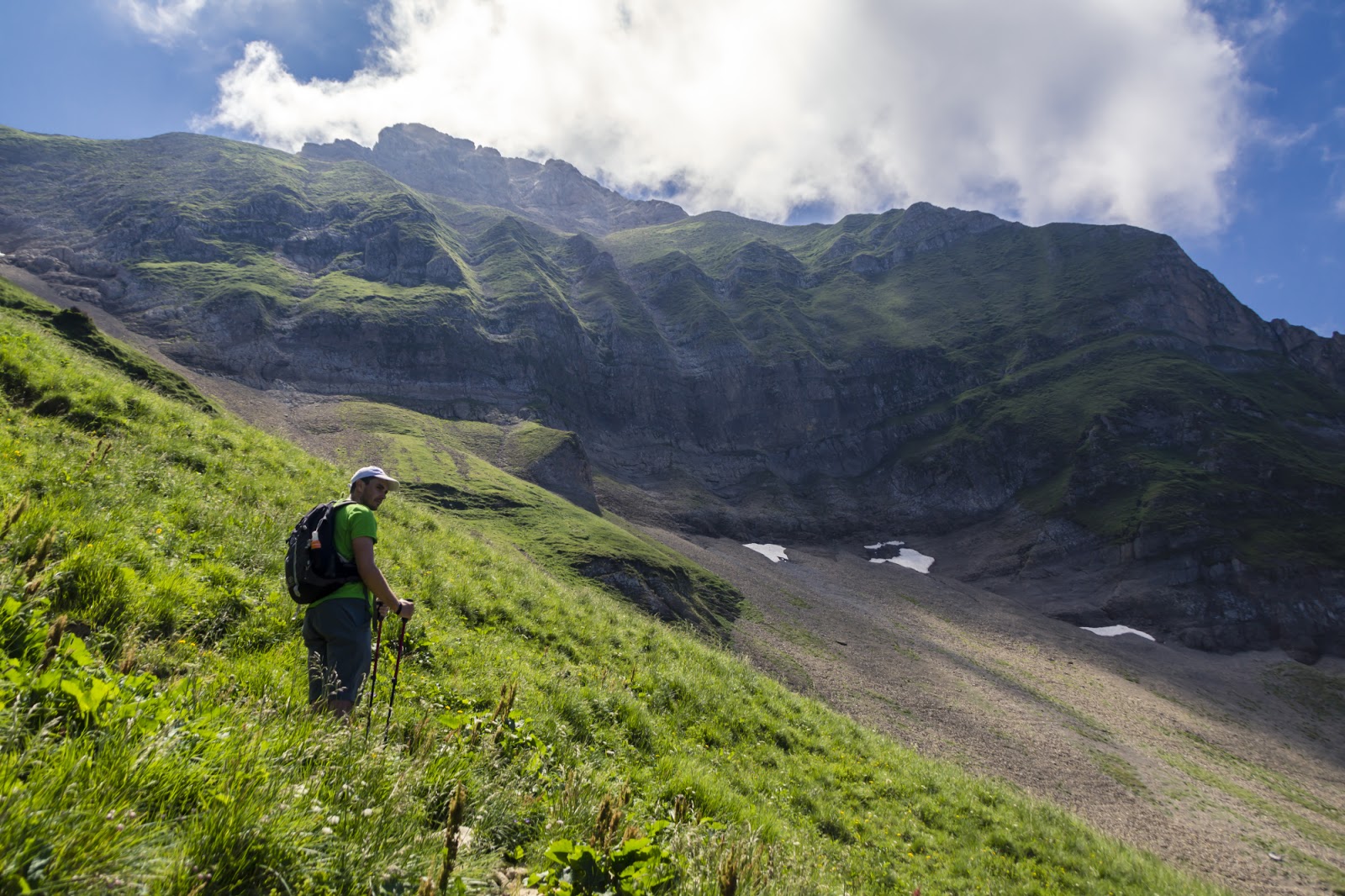
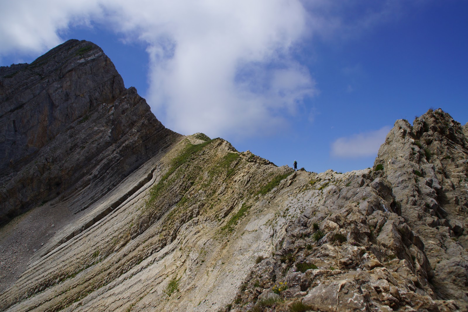
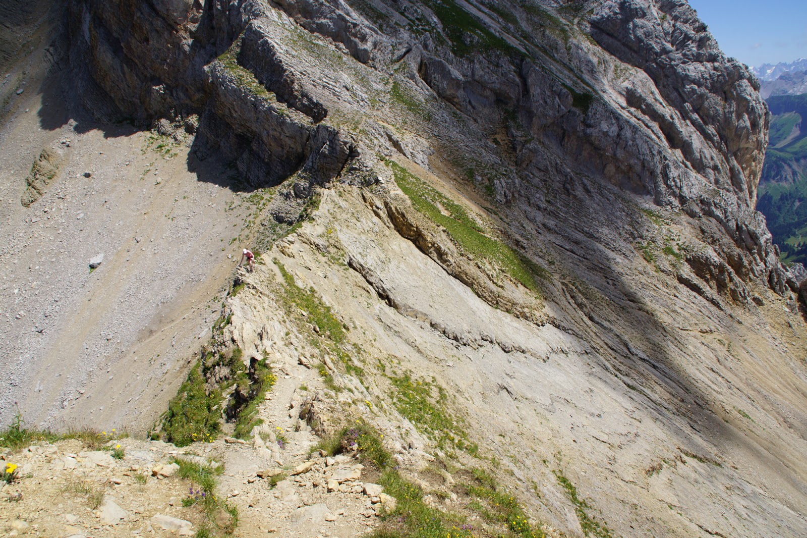
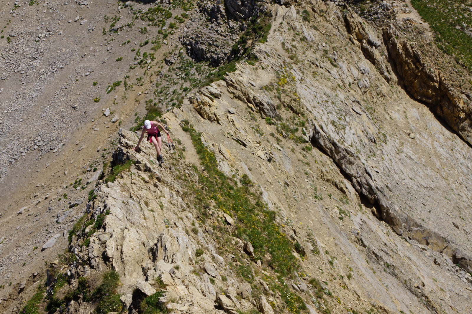
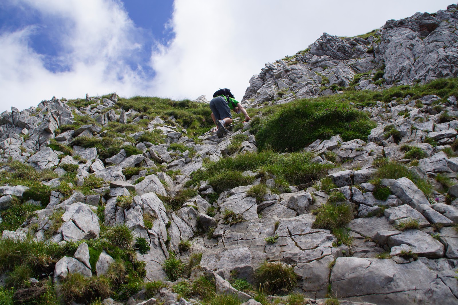
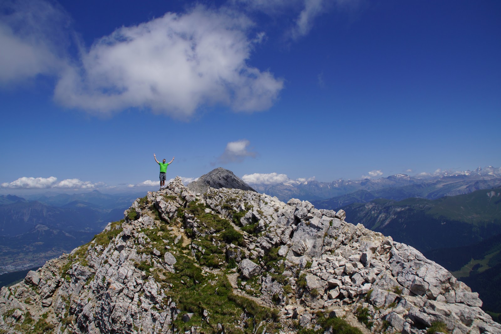
There was no path as such – in principle we had to scramble the rocks all the way up to the summit. Sometimes it was a bit challanging but most of the time it was pure and utter fun for both of us. Except for maybe two very delicate and technical passages, there was nothing to fear of from my perspective.
Have a look at this short video for the notion:

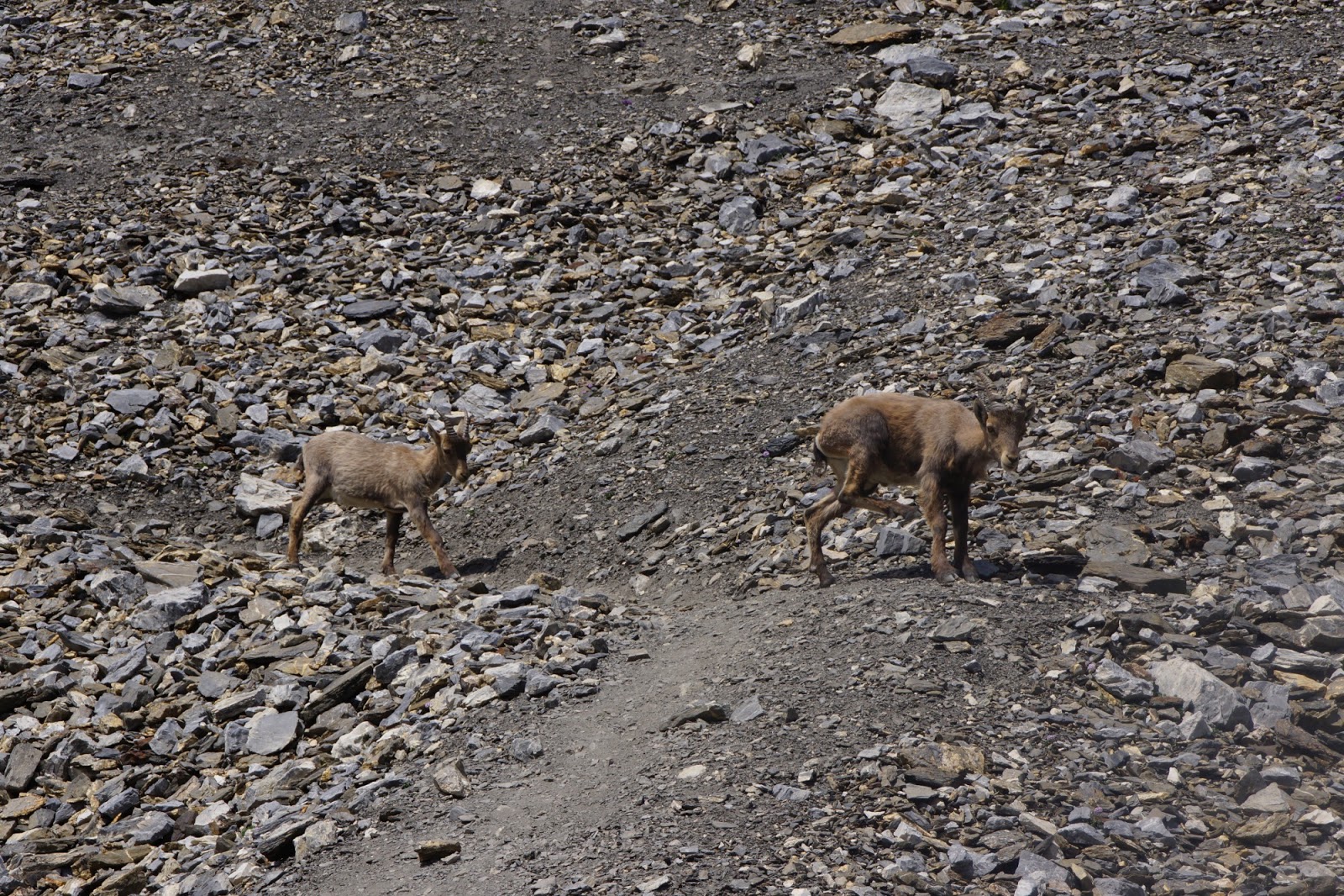
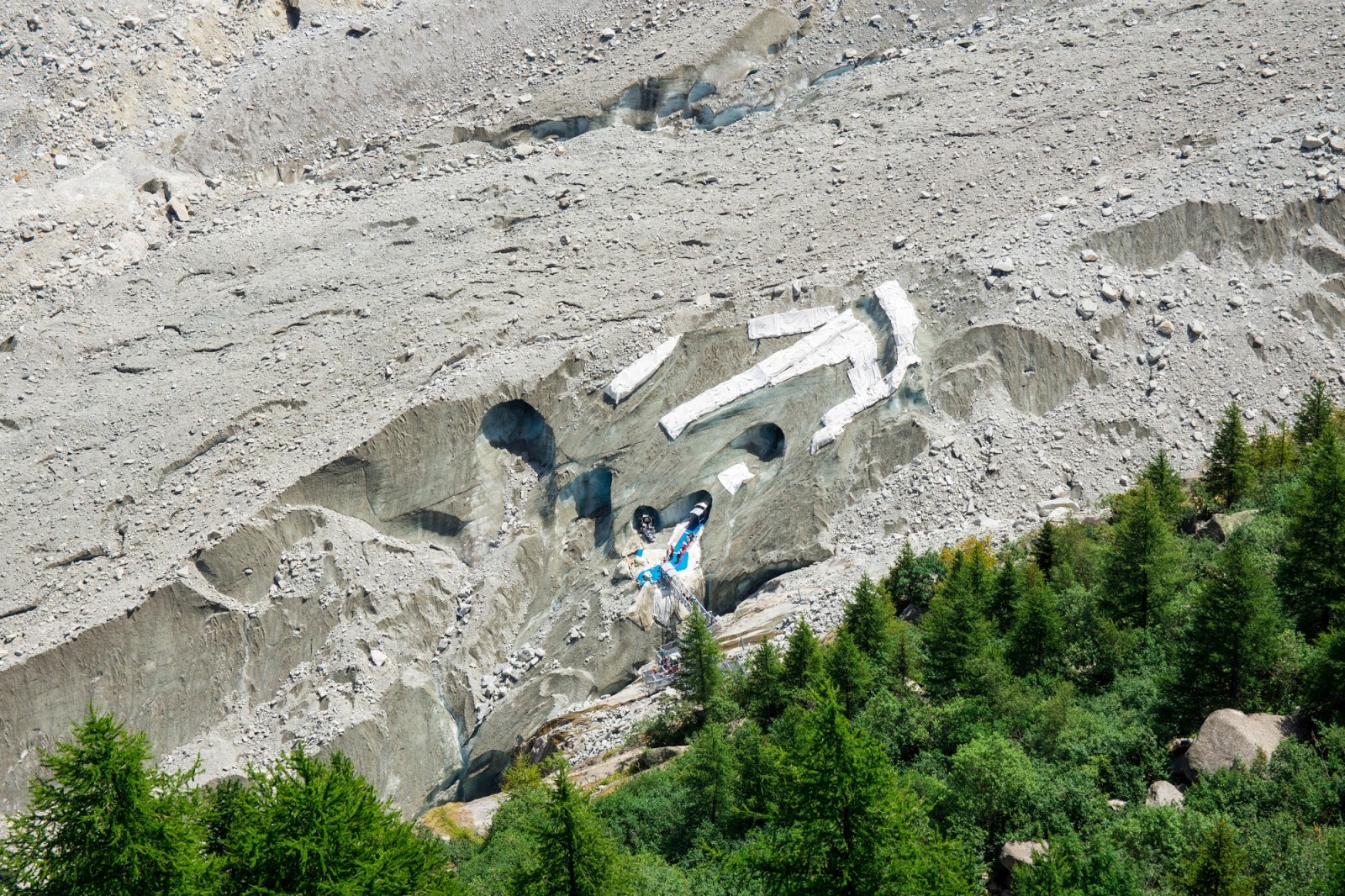
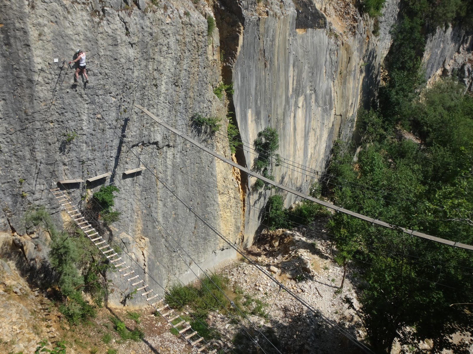
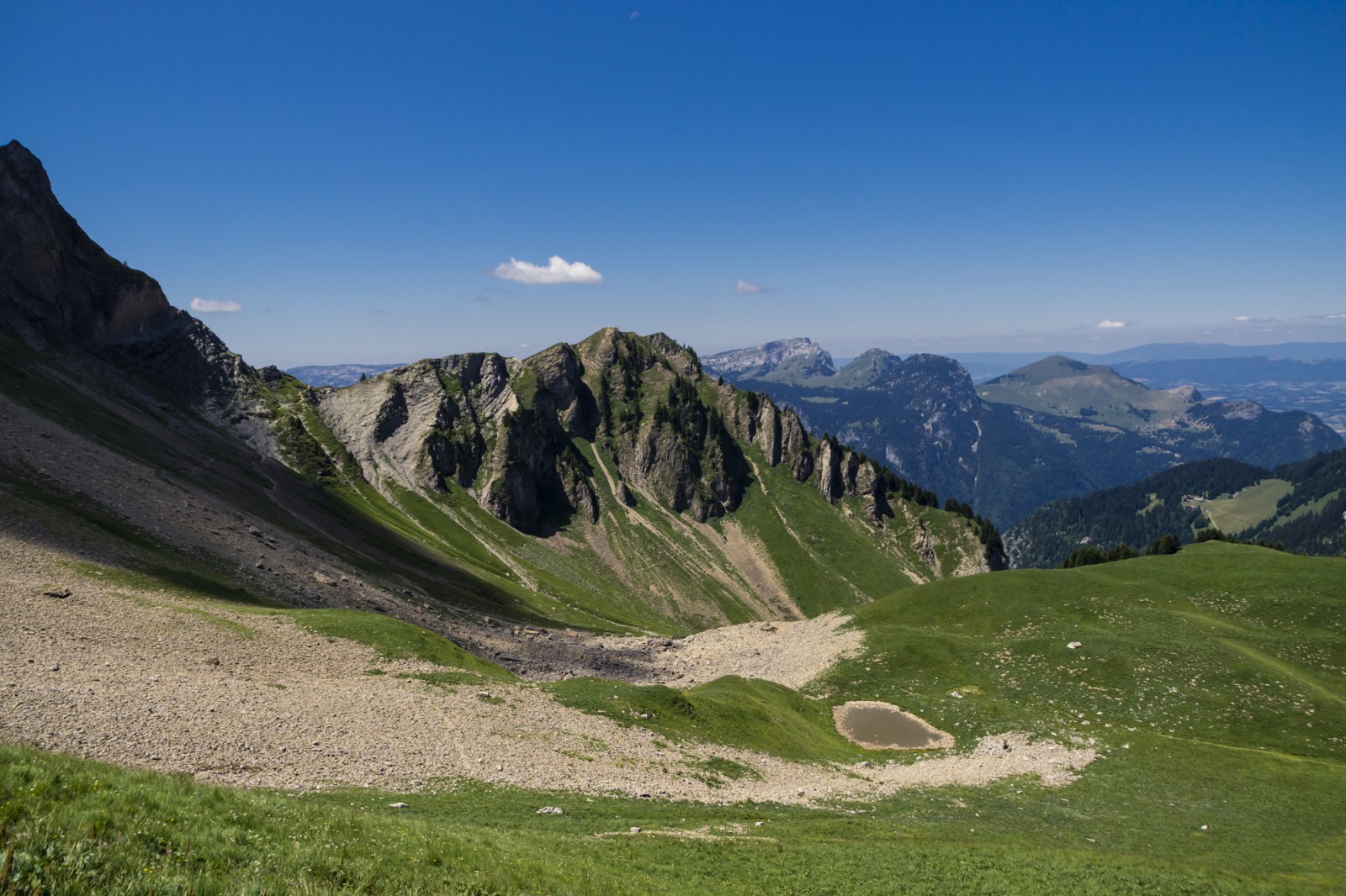
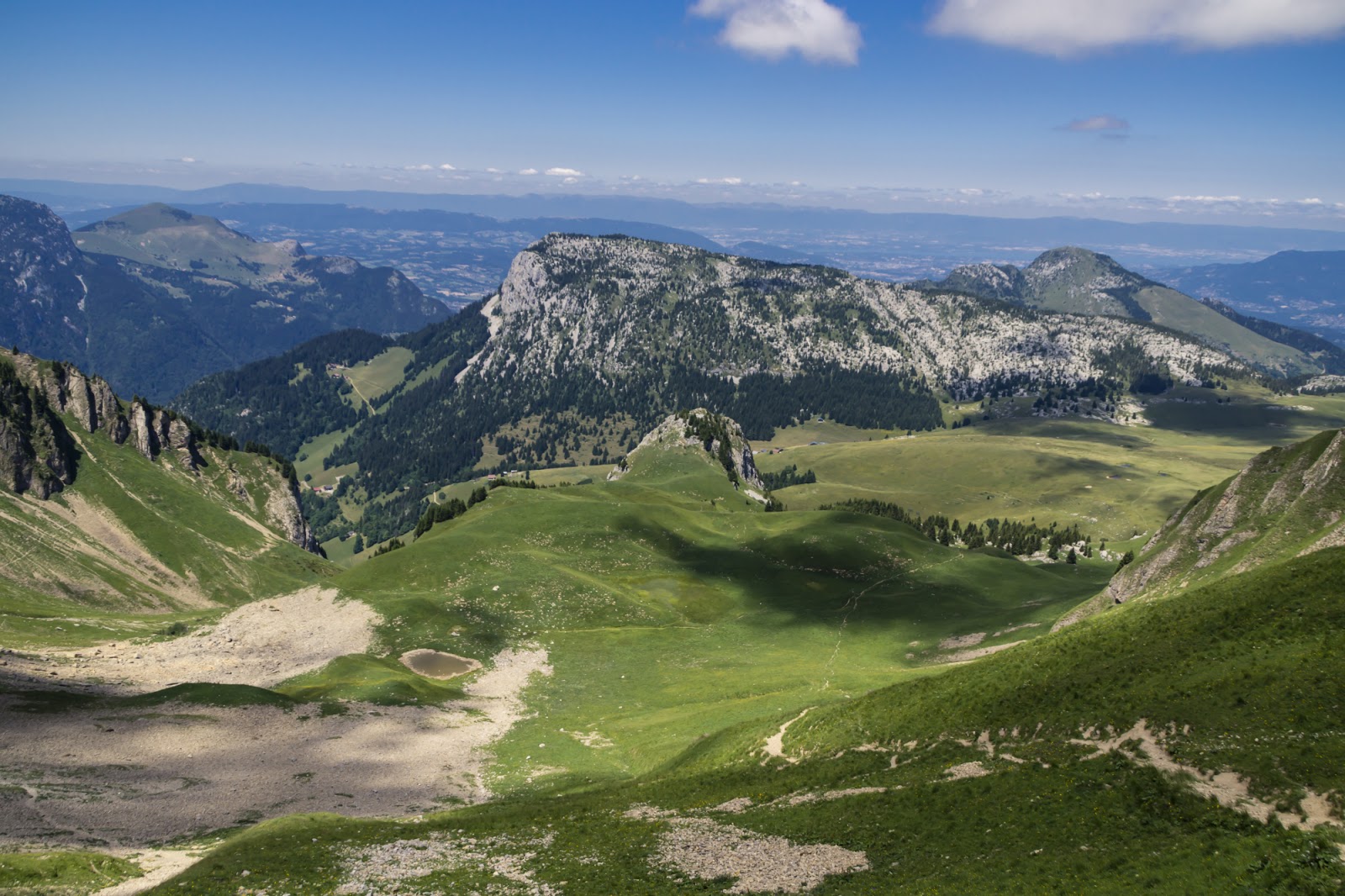
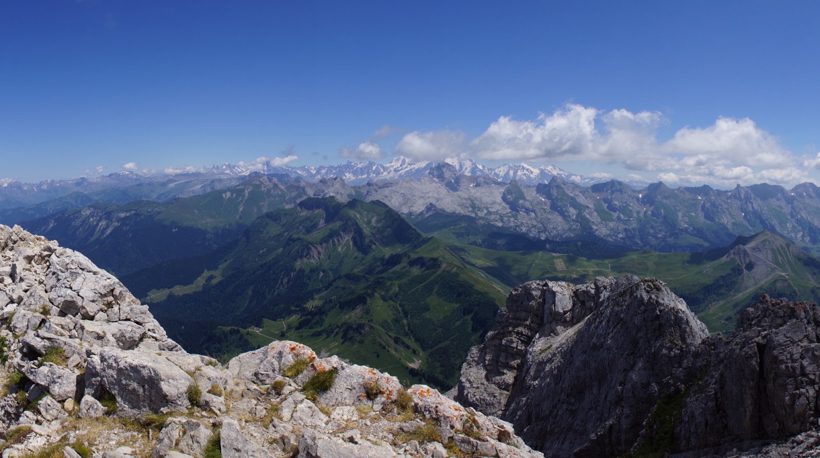
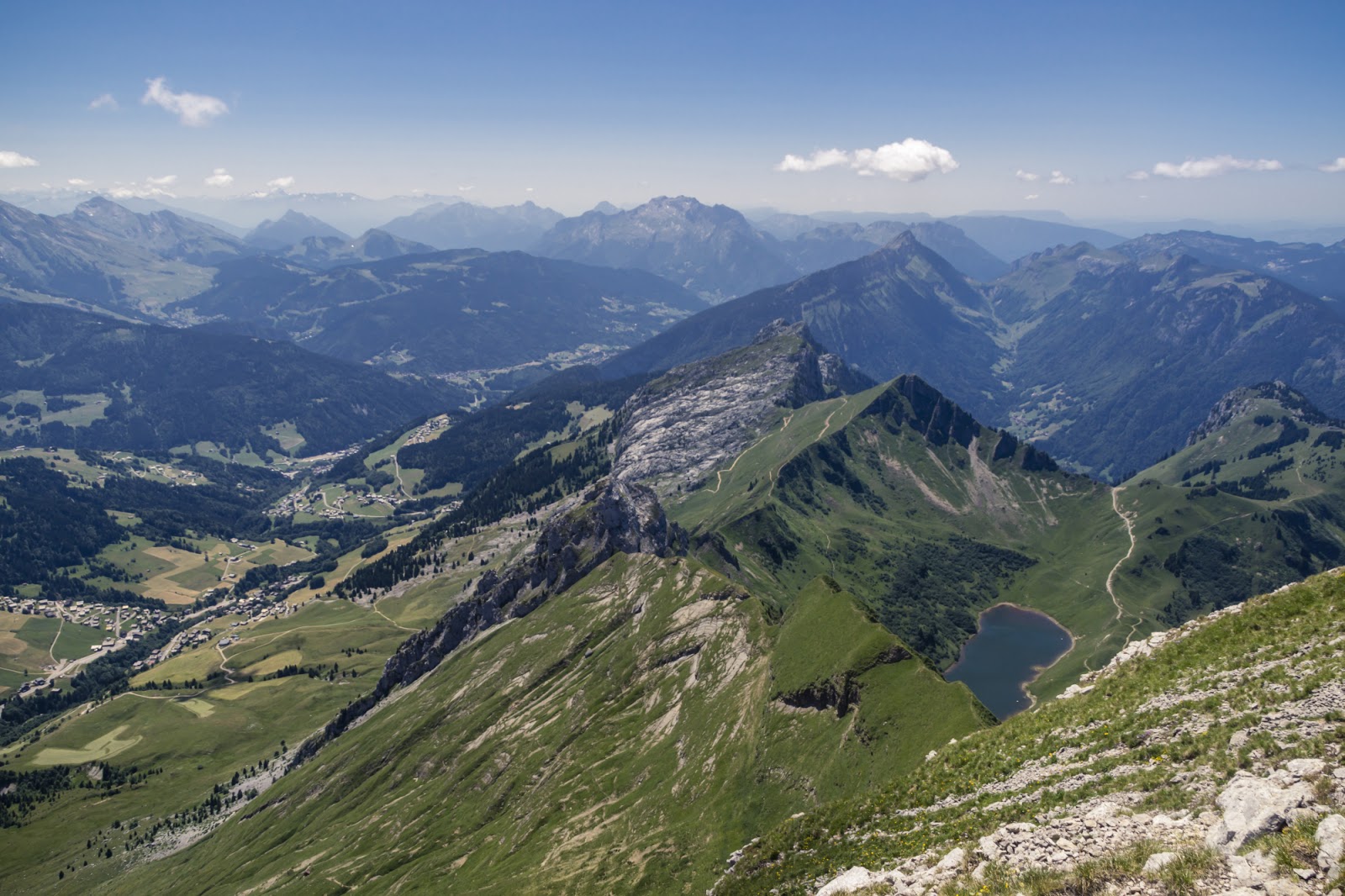
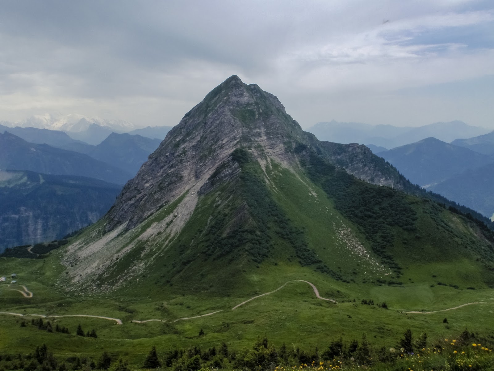
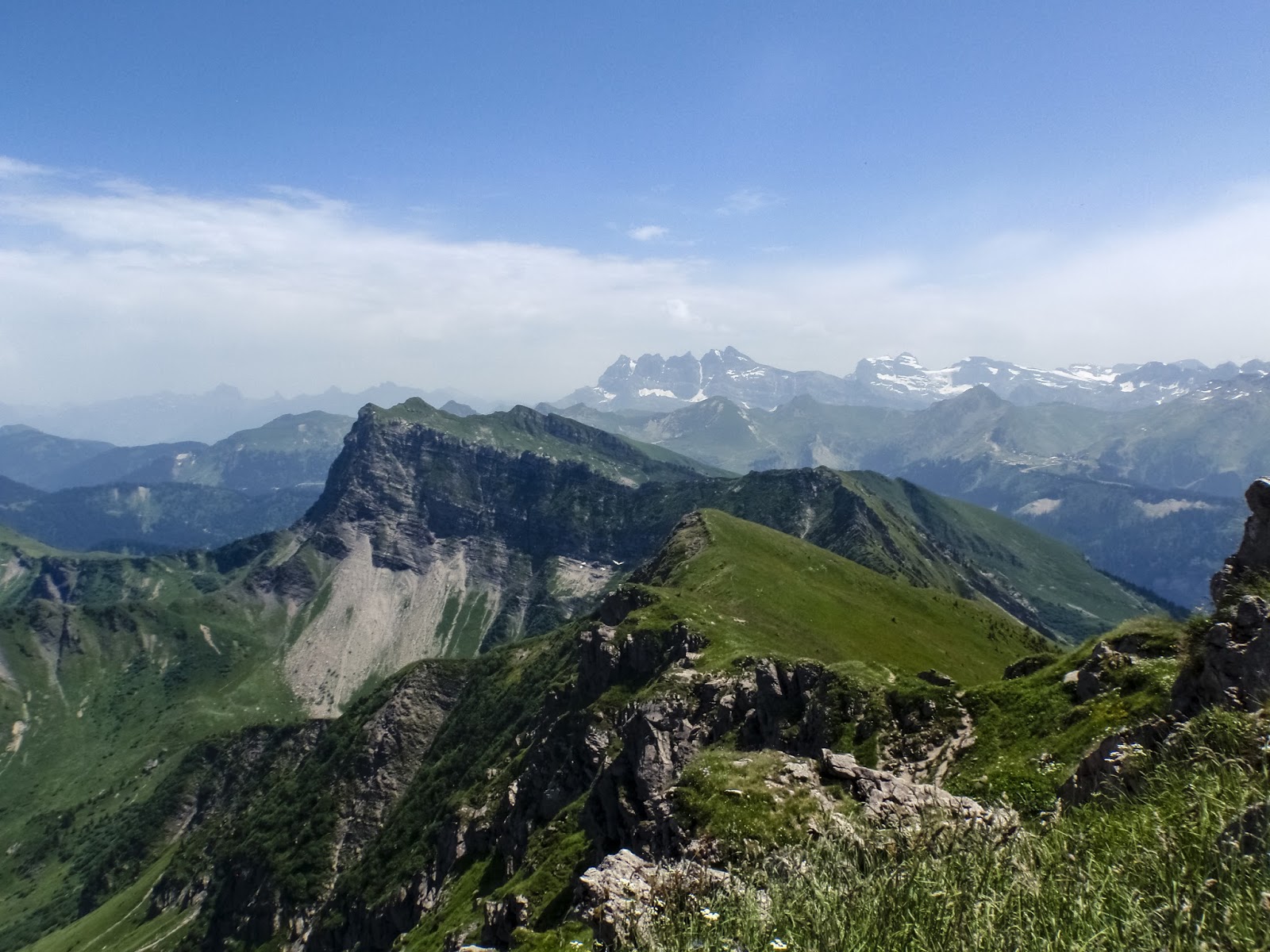
And a couple of photos from the process:

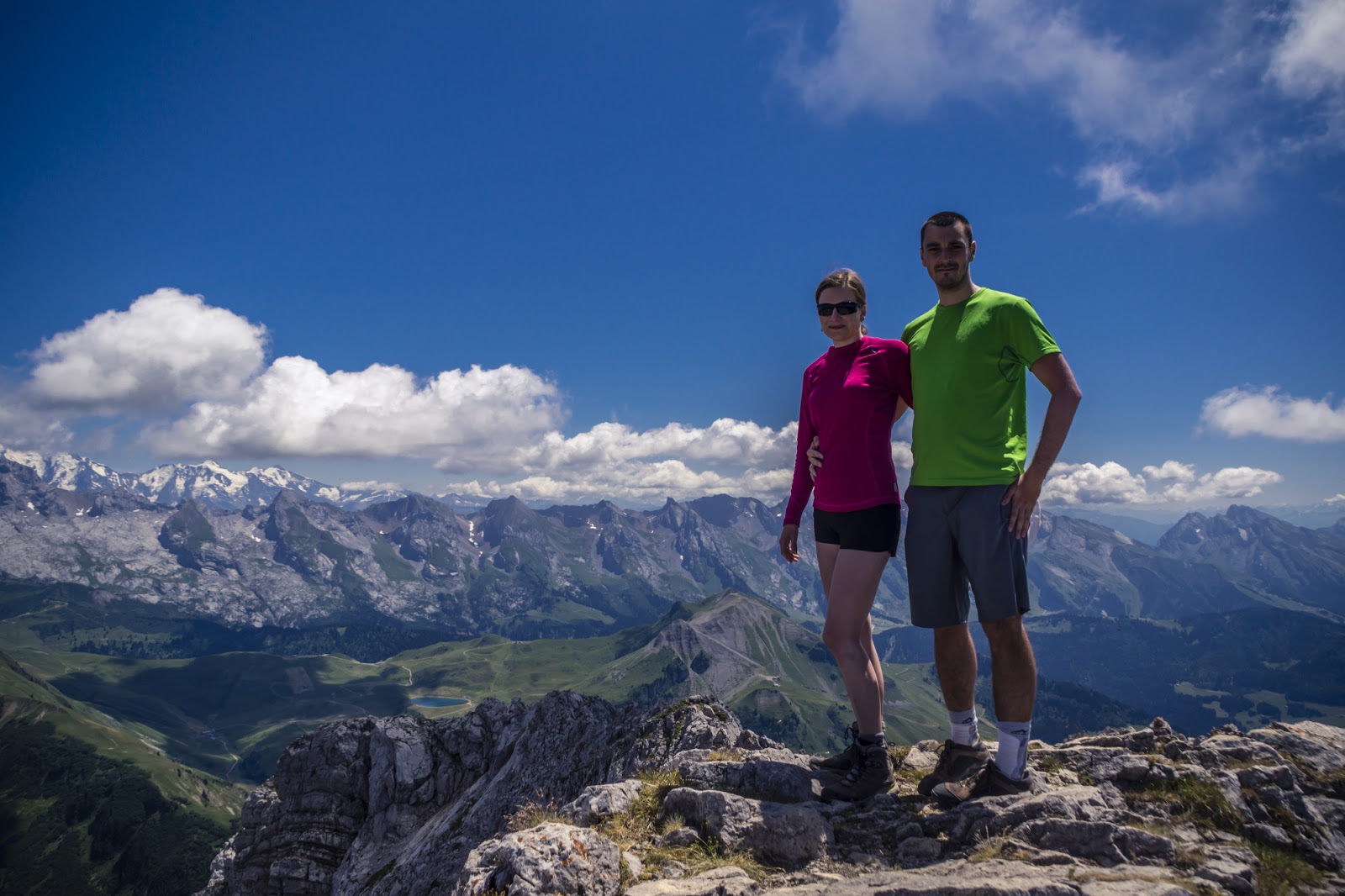
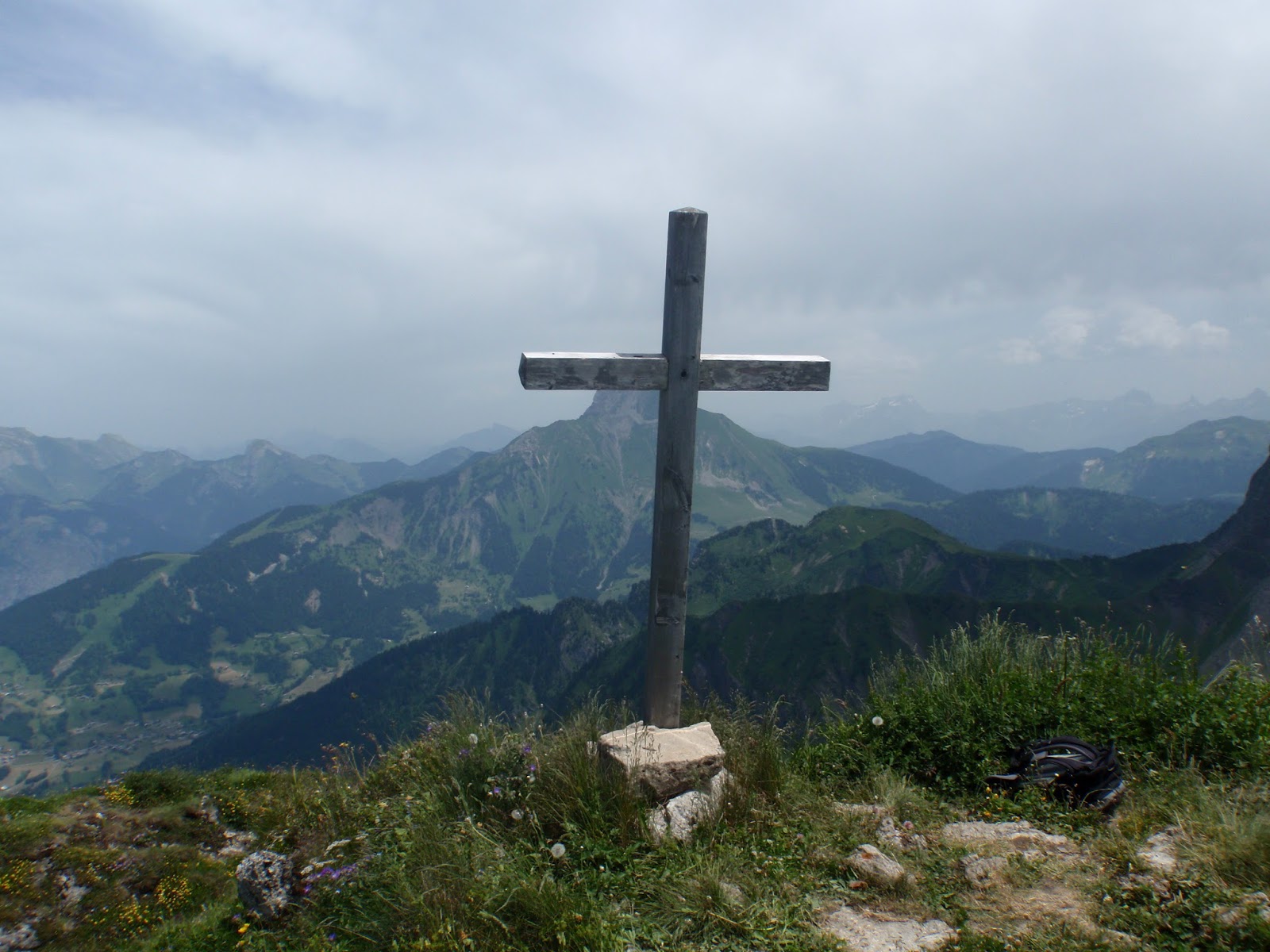
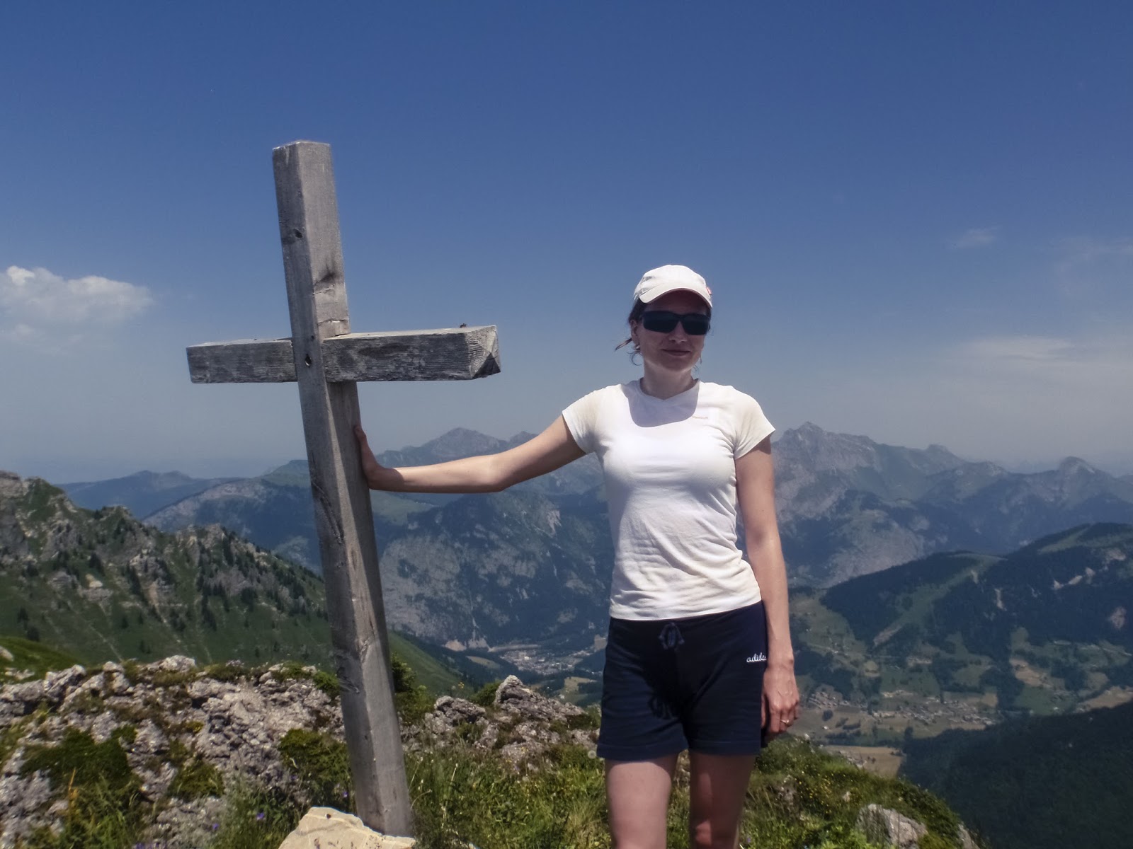
Once we reached „gendarme” (a pointy rock that looks like a guard of the entrance to the other side of the mountain) we were back on a T4 path and we were only minutes from the top. Since Pointe Percee is the highest of the Aravis mountain chain, it’s pretty well-known and cared for. That is why on the top there is a huge cross and even a guest book where we left our memento.

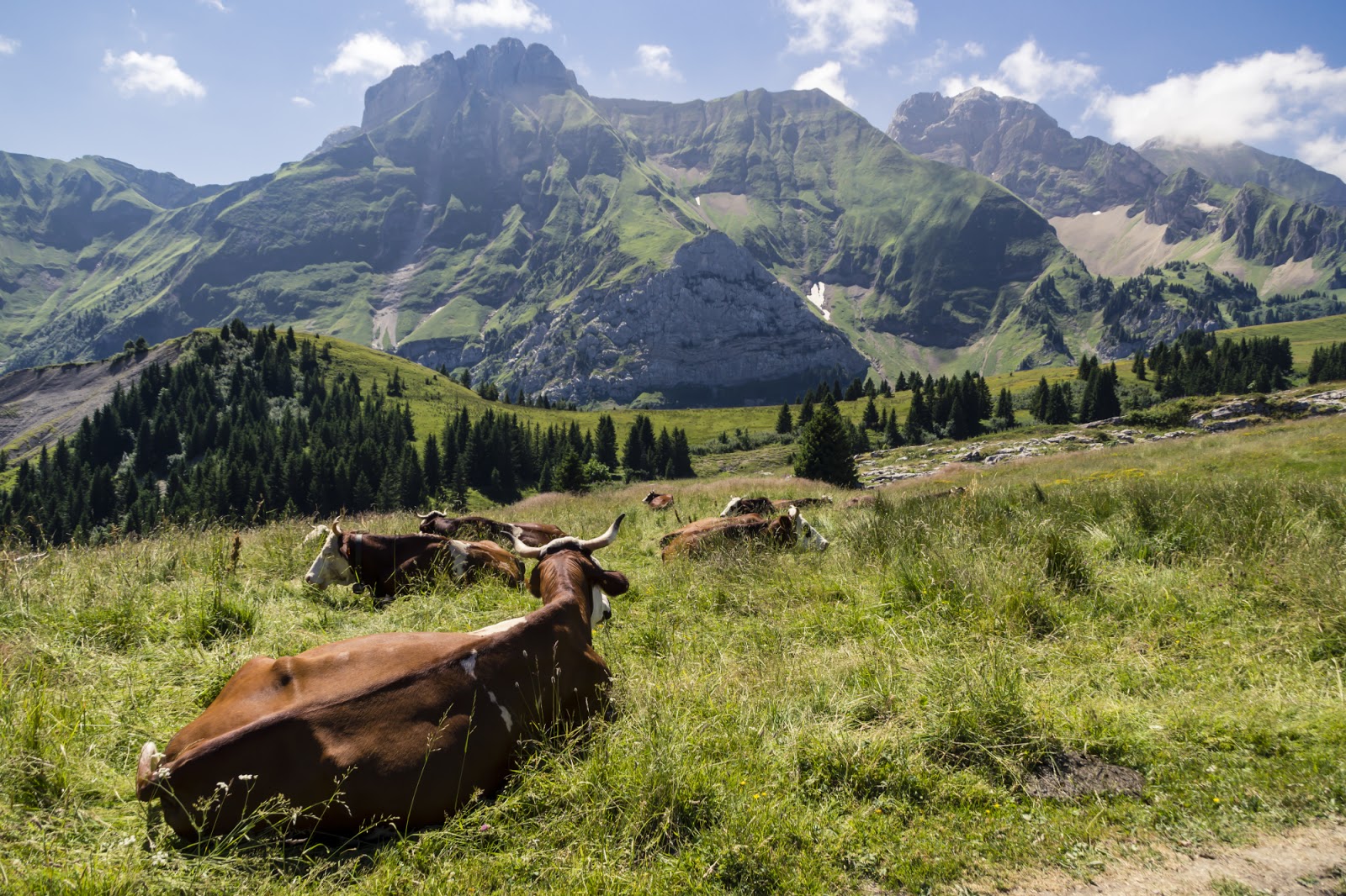
We knew that going down would be a bit of a pain on a route like that but we really didn’t expect it would take as long as an ascent. But in the end, it’s way more difficult to descent in such conditions than to go up. Personally, I was glad when we reached Gramusset hut and the annoying rocks ended. On the car park we entered a local farm to buy some goodies – cheese, youghurts and fresh cow milk. Yummy!

Stats: length: 9.1km; Time: 5h 20min, Elevation gain: 1200 m

Mont Buet (3096m)

With no doubt a top 3 hike for us – Mont Buet. I was pretty excited to be doing this one as I know of many people who did Buet and they all underlined the magnificence of the route. We started early in the morning as the walk would be long (all in all over 8h) and the day was exceptionally hot (like all the others this summer) so we wanted to reach high altitudes by the noon.

Apparently, departure at 8 AM was still too late to avoid the heat wave and I barely reached refuge de la pierre a berard. Fortunately, soon the heights started to cool down the air and after 10 minues in the shade we continued our walk in changing landscape.

Our next stop took place at the plateau right before a final ascent to Buet. Oh dear lord, look at the views! The final metres were rather easy, although quite slow and tedious as the altitude gave us signs with shortened breath. But we made it and it was totally worth it!

Goodbye Mont Blanc

It’s not really a secret that I set my heart on claiming Mont Blanc. Although I never felt the goal was near, I’ve always had it in my mind and every time I saw the mountain it reminded me of my dream. Today I already know it’s not going to happen during our current stay in France, as we are soon leaving.  It doesn’t mean that I let go but it for sure complicates a lot. So I feel lots of regret when I see climbers like in the photo above. I have to say – my last trip to Chamonix was very nostalgic.

We took Radek’s mum to Chamonix and we did all the musts there:
– we took the cable car to Aiguille du Midi (at staggering 3842m)  to get as close to Mont Blanc as possible for tourists,
– then we took Montenvers train to Glace de Mer glacier where we entered the ice cave.
Ok, what’s missing is step into the void (the glass cage on top of the steeple) but that was closed at the moment and Radek’s mum didn’t really feel like hanging over a chasm. We made a rather fast tour over Aiguille du Midi because lack of oxygen was taking its toll. So last final look at the climbers and off we go to the lower land where Radek and Wojtek were waiting for us.

In Chamonix we walked to the train station, stopping by at Pattisserie’s to stock up on some gooddies. Montenvers train is very nice itself, meandring slowly through forests and mountains. A 20-minute ride took us to the glacier departing station where we had an unexpected mandatory break because the baby got rocked on the train and fell asleep in daddy’s arms.

Once nap time was over we all headed to the ice cave. Because the level of the glacier decreases every year, we first needed to take a cable car down and then walk some good amount of stairs to reach the cave. This really makes you understand what global warming is… Call me an eco-freek but it was very depressing to me. Nevertheless, the amount of ice in Mer de Glace glacier is still overwhelming. It’s not seen at the first glance as it’s mostly covered by rocks and dust but the gray surface down there in the photo above it’s all ice underneath. Should you not believe, have a look at our photos from the ice cave carved at the heart of it.

 And so we finished the day. It’s hard to be parting with places I love but I’m looking forward to what future brings. Some new areas to discover – that’s for sure.
 

Refuge du Plan Glacier (2680 m)

Another place from our „to do list”. Last year we didn’t have weather good enough to realize all our hiking plans so we must make it up this year. Refuge du Plan Glacier is not exactly a mountain, but it’s situated in the heart of Alps, with such beautiful views on the valleys and glaciers around. We started close to Chamonix, so the area well known to us. At first the path was pretty mild, going mainly flat or with mild elevation gains.

Then we continued on a very steep, physical passage (but nothing technical) up to Col de Tricot. That was quite a work out! Up there – lots of amicable sheep craving for our lunch, lovely views and many tourists having a break.

From there on we continued in the direction to Plan Glacier refuge. Not many hikers followed our footpath as the whole tour from Gruvaz would be rather long and require a lot of stamina. That didn’t put us off though! The landscape soon changed as vegetation left place to bare rocks and we approached the glacier. Did I mention I love glaciers? 🙂

At times it got technical but nothing scary in good conditions like that day.

And finally, the refuge. I was pretty happy we finally reached it, I was a bit worn down by this long ascent. We sat down under the shelter, ordered some local goodies, studied the map and ate some chocolate (thanks Arnaud!). The glacier was at my fingertips, really and every time I find myself in such a situation I just want to put on the gear and continue… I guess some day I’ll grow to this and we’ll start mountaineering. I think Arnaud had the same feelings because two weeks later he went on a trip with his friend and the route they covered was from Plan Glacier, to the next refuge (crossing the glacier) and up to the neighbouring mountain. But that required the gear and skills that we currently don’t have. I’ll put it on my „dreams wish list”.


Stats: Length: ~20km, duration: 7h 45min, elevation gain: 1650m.

VF Morez

We’re not done yet with via ferratas. It teaches me a lot to go out of my comfort zone and conquer all the fears. And after the second time on the wall I can already tell – it gets easier and easier. Today’s route technically was actually not complicated. The only passage that gave us a thrill were the two bridges stretched between smooth, vertical walls. I had quite a pickle finding the right way to place my feet and not to fall. But I’m starting to like this sensation of rushing heartbeat out there!

 As I said, the rest of the route was rather easy and we had lots of fun in our little group. The views were nice so every now and then we stopped by to have a look at the valley. I’m still not decided if it’s going to be my hobby or not. I guess we need another try 🙂

And a short movie from the day:

VF Fort l’Ecluse

We’re trying to tuck in as many activities as possible before our departure home. In the end, it’s our last chance to try via ferrata (we have no such attraction in Poland). It’s actually surprising that we haven’t tried it earlier – there are so many around, it’s in mountains, it requires a lot of interaction with forces of nature, it’s challanging… But somehow we hesitated until now.
We chose a route that is 15 minutes away from our place, at the rock of Fort l’Ecluse. We really didn’t know what to expect except from nice views that we know well by now. So we set off full of excitement.

As you can see from one of the photos above, it was scary 🙂 It was actually the scariest thing I’ve done so far in mountains. It was so scary that at some point I froze somewhere on the rock unsure how to proceed so that I don’t find myself hanging from a vertical wall. But it was fun! I enjoyed it a lot and once the fright passed, we were left with excitement and smiles on our faces. In the beginning we weren’t sure if we wanted to repeat it or not but after a while we decided to give it another try so stay tuned for more of daredevil via ferrata acrobatics 🙂

An overview of the route:

Pic de Jallouvre (2408m)

Holidays! Our first outing – Jallouvre. Not too difficult but also not too easy – just fine for the start of the season. And the views…

After a mild and longish start where we somehow managed to lose a path, we began the ascent. We were moving quite quickly wanting to leave the heat behind and reach cooler temperatures in hights.

We were fast so we reached the fun part in no time. I knew we would be going on a dramatic ridge but apparently we became too much of daredevils as our heart rates didn’t speed for a second while crossing it. But it’s always fun to go past such a technical passage.

After the ridge there was a short steep passage and the top already. The views were truly amazing.

Stats: Length: 13 km; Elevation gain: 900m; Time: 4h

Roc de Tavaneuse (2156 m)

What can you do when the temperature rises to 40 dg. C? Go to a beach or in the mountains. But the latter is also quite an extreme experience unless until you reach elevation of around 2k. I had a chance to learn it. My today walk with Arnaud wasn’t really challenging but the heat wave made it super difficult in the beginning. Also, I forgot my camera so the quality of photos leaves a lot to be desired. Therefore I show you only a couple – just to give you a taste of the views we had. I regret just one thing – I should have jumped in that lake!

Passerelle de Bionnassay

Today we made a family walk in valley of Bionnassay. Five adults, three babies, 7 kilometres, 500 m elevation gain and one suspension bridge – that was the plan for today. We had lots of fun together, it’s nice to be watching kids discover the beauty of nature.

There is really not that much to say about this trip. We escaped the heat (over 30 dg. in the plains) to a nice mountain breeze, we enjoyed the easy path and had lots of fun crossing the passerelle. We will soon be back in this region with Radek, but we plan to do a more challenging hike that will lead us to the glaciers that we can see in the pictures. So stay tuned!

Discovering France, Switzerland, Poland and Italy in spring

This spring was plentiful of activities for us. the weather is very good this year so we can benefit from that having 1-day trips around, we did an almost 3-week trip to Poland and went for holidays on Sardinia. here are some flashbacks from this time.

Versoix:

Toddler’s Group Bake Sales:

Szczecin:

Annecy:

Meyrin:

Sardinia: